-
by
Joe Lombardi
Weather
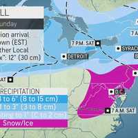
One of the most active weather patterns in years will stay on display through the weekend and into next week.There will be more snow at times during that stretch, but sleet and ice could pose more significant threats, with the possibility of potentially major power outages from damage to utility lines and trees as well as treacherous travel.There will be a chance and snow and sleet ...
-

by
Joe Lombardi
Weather
A quick-moving storm system arrived in the area just after daybreak on Tuesday, Feb. 9, bringing a mix of snow, sleet, and freezing rain to the area and creating hazardous driving conditions in parts of the region.A Winter Weather Advisory is in effect from 4 a.m. Tuesday to 1 a.m. Wednesday, Feb. 10 for the areas shown in the first image above.The highest snow will be during the ...
-

by
Cecilia Levine
Weather
A newly-released forecast called for two rounds of precipitation Sunday, with winter weather advisories issued for parts of North Jersey and Eastern Pennsylvania.The first was snow, and it was making its way across North Jersey and Southeastern Pennsylvania as of 8:15 a.m. Sunday, the National Weather Service said.Between two and four inches of snow and sleet were possible in North ...
-

by
Kristin Palpini
Breaking News
Freezing rain and frosty mornings are predicted for the weekend of Dec. 12-13 ahead of a developing snowstorm that could hit next week.The National Oceanic Atmospheric Administration is predicting a 70 percent chance of freezing rain and patchy fog early Saturday morning. More showers could fall in the evening. Temperatures may reach a high of 42 degrees.Sunday will be the more pleasant ...
-

by
Joe Lombardi
Weather
A storm system has brought steady rain to the region, with areas far north and inland seeing sleet and some snow, leading to delayed school starts.The unsettled weather pattern will continue the next few days, with a new chance for a wintry mix that is expected to be more widespread.Monday, Feb. 10 will be cloudy with showers and pockets of heavy rain at times during the day and evening ...
-

by
Joe Lombardi
Weather
A storm system that will bring a mix of snow, ice and rain to the region will follow a return to more seasonable temperatures.Milder air arrives on Thursday, Jan. 23, which will be mostly cloudy with a high temperature in the mid 40s and wind-chill values between 25 and 35 degrees.Friday, Jan. 24 will be partly sunny with a high temperature in the low to mid 40s.Then comes the chance ...
-

by
Joe Lombardi
Weather
Rain has started to move across the area and has transitioned to freezing rain and sleet farther inland even in some spots where the temperature is above the freezing mark as a complex storm has arrived in the region.The wintry mix has been reported after nightfall on Sunday, Dec. 29 mainly north of Interstate 84, especially in areas with high elevations.Freezing rain, sleet and snow ...
-

by
Joe Lombardi
Weather
Click here for an updated story: Storm Bringing Mix Of Freezing Rain, Sleet, Snow Causing Hazardous Travel ConditionsNew projected snowfall totals and info on timing have been released for the powerful storm that will bring a mix of snow, sleet and freezing rain to the region.The storm will arrive late Monday night, Dec. 16 and continue through Tuesday evening, Dec. 17.A total of 3 ...
-

by
Joe Lombardi
Weather
Click here for a new, updated story: Projected Snowfall Totals Increase For Powerful Storm System That Will Sweep Through AreaAs a powerful, quick-moving storm that will bring a mix of snow, sleet and freezing rain nears, Winter Weather Advisories have now been issued for much of the region.The advisories are in effect from 6 p.m. Monday, Dec. 16 until 6 p.m. Tuesday, Dec. 17 for the ...
-
by
Joe Lombardi
Weather
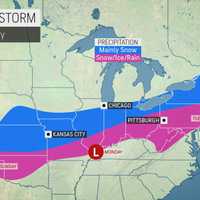
Click here for an updated story: Winter Weather Advisories Now In Effect For Much Of Region As Storm NearsA powerful, quick-moving storm will bring a mix of snow, sleet and freezing rain to the region early this week.The time frame for the wintry mix with snow at times is Monday afternoon, Dec.16 into the morning on Tuesday, Dec. 17.At this time, about an inch of snowfall accumulation ...
-

by
Joe Lombardi
Weather
Click here for an updated story: Accumulating Snowfall Now Expected For Early Week StormGet set for a stormy stretch with two separate systems due to move through the region, with the second bringing a wintry mix and snow.The first storm system will usher in the start of the weekend. But temperatures began to rise as it arrived on Friday afternoon, Dec. 13, keeping precipitation to ...
-

by
Joe Lombardi
Weather
Don't adjust your calendars.It really is April. But spring won't be "a thing" to end the workweek.That's because a storm system will bring rain to the entire region, with freezing rain farther north with some spots possibly even seeing some -- are you sitting? -- snow.The storm system arrives early Friday morning, April 5 with rain farther south. Areas north of I-287 and the Merritt ...


